Welcome to the third edition in the series "Volunteers on the Go". Two of our activities that were on hold due to the pandemic are now back on line (with Covid-19 protocols): the bi-weekly water sampling at the Orange Bridge in Parksville that we do for Environment and Climate Change Canada (ECCC); and the Forage Fish Spawning Habitat sampling we do monthly (sometimes biweekly) in partnership with Vancouver Island University (VIU) and the Mount Arrowsmith Biosphere Region Research Institute (MABRRI).
Water Sampling at the Orange Bridge
The Orange Bridge spans the Englishman River in Parksville and is one of several long-term freshwater quality monitoring sites in the coastal watersheds of British Columbia. MVIHES has been collecting water samples from the Englishman River at this location and sending them to an analytical laboratory on behalf of ECCC for approximately 15 years. ECCC uses the data to assess water quality status and long-term trends, detect emerging issues, establish water quality guidelines and track the effectiveness of remedial measures and regulatory decisions in the Pacific Basin.
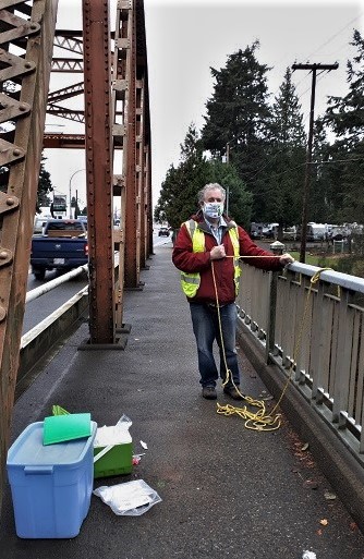
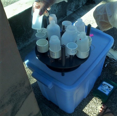
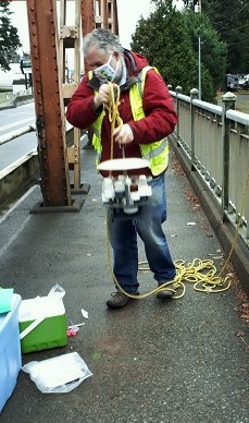
ECCC supplies MVIHES with bottles that are placed in a rack (seen in right-hand photo) and lowered by a rope into the Englishman River for filling. Each bottle in the rack is used for analysis of specific parameters such as heavy metals, E. coli, nitrogen, chloride, water hardness, turbidity. Once the bottles are filled they are packed into a cooler with cold packs that ECCC also supplies and sent to a lab in Burnaby for analysis. The results of the analysis are sent to ECCC and go into a public database.
The photo to the left shows actor and heart throb Mark Ruffalo on the Orange Bridge after he has lifted the sampling rack out of the river. No wait.....that's MVIHES volunteer and Board Member Bernd Keller! Yay Bernd! It's so hard to tell who's behind the masks these days. Well, whoever it is, he's getting ready to take the bottles out of the rack, put the lids back on the bottles, and pack them in the cooler to be shipped to the lab in Burnaby. Taking the photo is MVIHES volunteer Shelley Goertzen.
Forage Fish Spawning Habitat Sampling
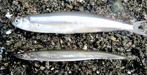
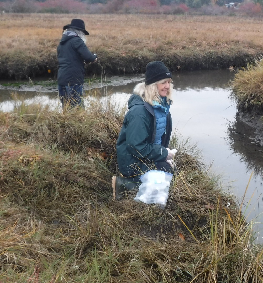
Since 2018, MVIHES has been identifying and sampling forage fish spawning habitat on the beaches from Craig Bay to the Parksville Community Park. Forage fish are small fish that travel in large schools and are a food source or 'forage' for larger fish and marine mammals and birds.They include Pacific Sand Lance (seen in bottom of photo) and Surf Smelt (seen in top of photo) which lay tiny eggs (1mm) on pebble and sand beaches just below the high-tide line - an area called the intertidal zone. It's important to identify and map beaches where forage fish spawn so spawning habitat can be protected from disturbance during the spawning window.
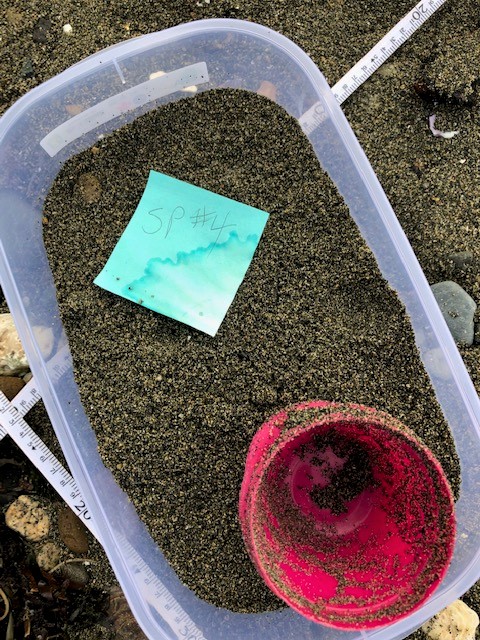
On November 10, MVIHES volunteers, including Brenda Little in the right-hand photo, collected habitat data and sand samples from 11 potential spawning sites. The sand samples, one of which is seen in the left-hand photo below, are sieved and "vortexed" to sort out the right sized sand grains where forage fish eggs and embryos can be found. The sorted sand from each site is placed in a sample bottle with a tag and checked under a microscope by VIU and MABBRI for the presence of eggs and embryos. In December of 2018 and 2019, Pacific Sand Lance eggs were found in the sand samples from the beach in San Pareil.
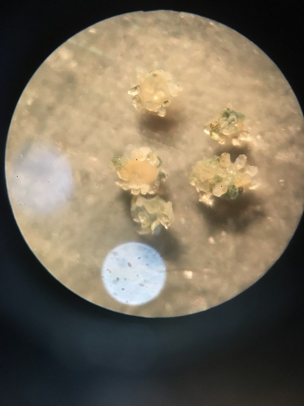
This time it appears Pacific Sand Lance eggs have been found on the beach in the Parksville Community Park. The photo to the right was taken through a microscope by MABRRI and shows five eggs attached to sand particles. The eggs are being sent to an expert with the Dept. of Fish and Game in Washington State for verification.
Other volunteers who were involved on November 10 and are suspiciously absent in all the photos taken that day are Don Lyster, Pat Ashton, Katrice Bauer, Shelley Goertzen, Peter Law and the Vortex Queen (Barb Riordan).
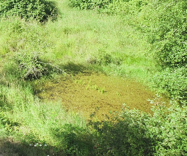
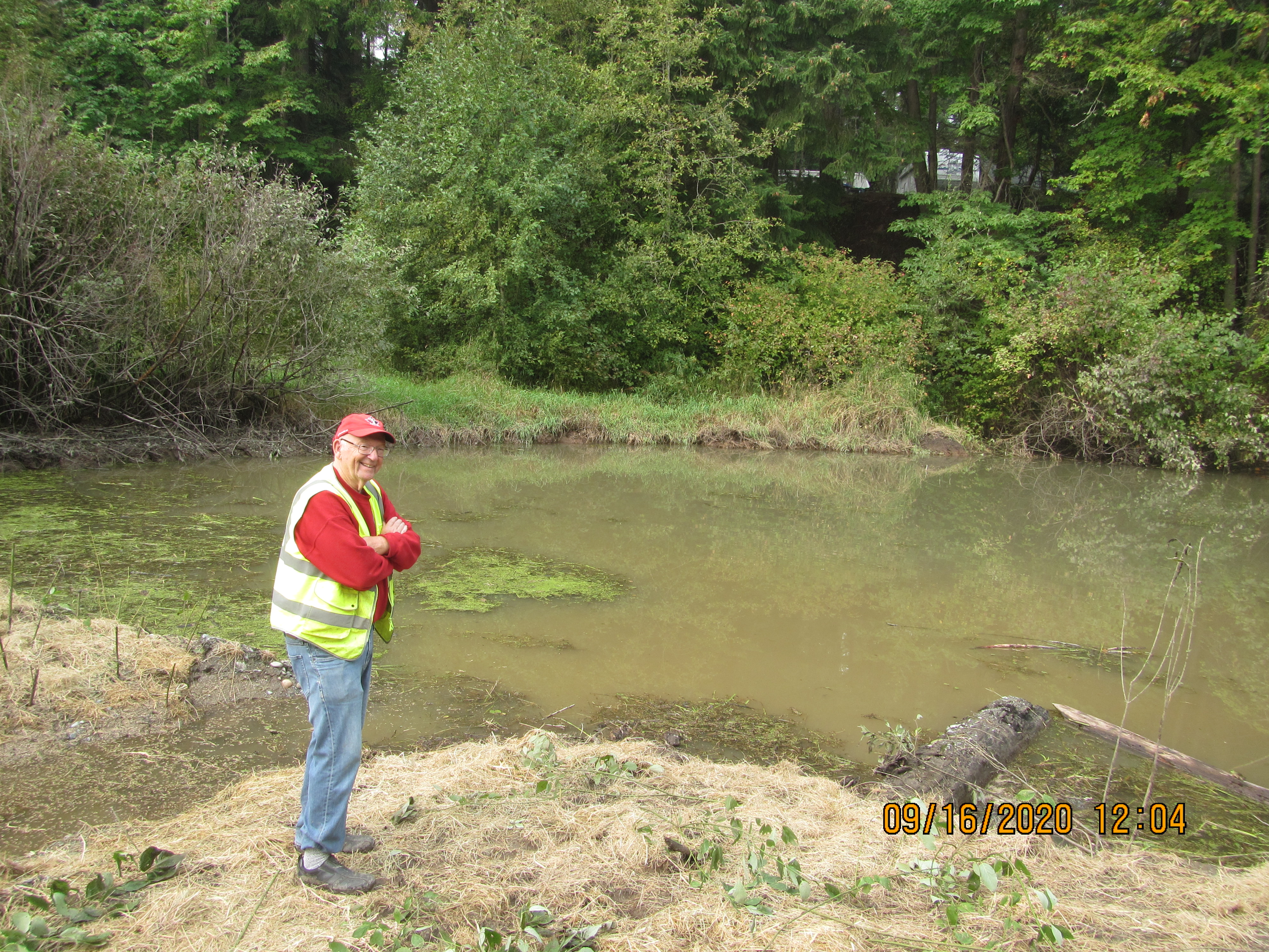
In early September, we took on one of our biggest fish habitat restoration projects in our 20-year history. Martindale Pond, home to thousands of overwintering Coho Salmon fry, had been filling with sediment and invasive plants like yellow iris and reed canary grass for years. Less and less habitat was available for the fry that develop into smolts and leave the pond for the Englishman River every spring. Juvenile Rainbow and Cutthroat Trout also overwinter in the pond and leave in the spring. The pond is also home to a turtle named Martin and two red-legged frogs named Dale and Dale (you laugh, but you try and tell one frog from the other). Drone footage of Martindale Pond - summer 2020
The pond desperately needed a good cleaning. We applied for and received funding from the Pacific Salmon Foundation for $50,000 to excavate the pond. A portion of the grant was contributed by Mosaic Forest Management, a sponsor of the Community Salmon Program. An application for a “Notification to Changes in a Stream” was submitted to the provincial government and a permit from the City of Parksville to work on City Property (Martindale Rd and road allowance) was also obtained.
Parksville Heavy Equipment was contracted to dig out the pond and haul the sediment in dump trucks to the Shelly Farm where it was spread on the fields as fertilizer. Over thirty truckloads of sediment were removed!
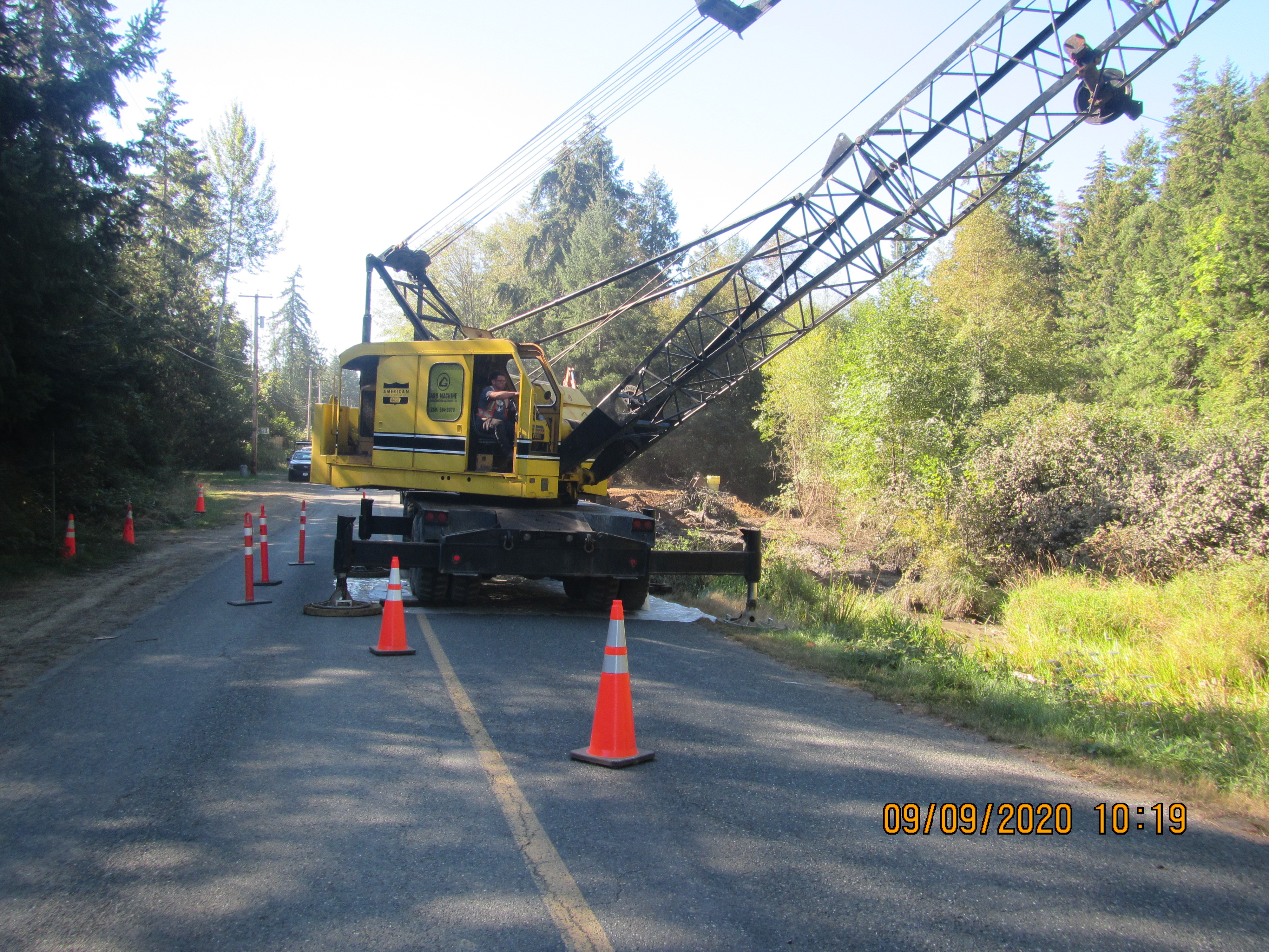
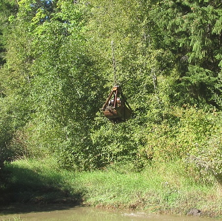
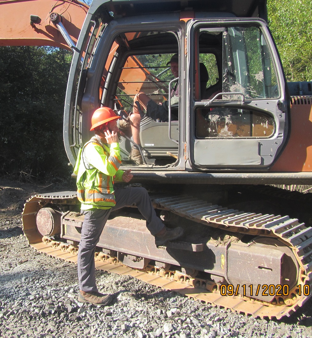
A crane with a "clamshell" bucket hanging off the end of a 90 foot boom was used to grab the sediment from the pond and dump it beside a sump that allowed water to drain out of the sediment without running back into the pond. An excavator then picked up the sediment and placed it in a dump truck. See photos below.
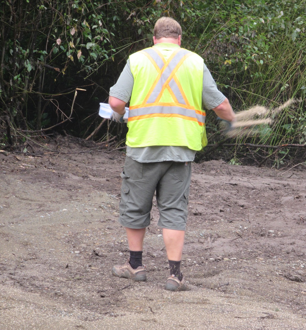
Biologist Dave Clough (right-hand photo) was on hand throughout the project to make sure erosion control measures were functioning as designed. Following removal of the sediment, the area that had been disturbed by the trucks and heavy equipment was rehabilitated under Dave's supervision using methods that are standard practice for Parksville Heavy Equipment. The area was graded and made smooth so that a fast growing grass seed mix prescribed for erosion control could be spread. Straw was spread over the area for a couple of reasons. The straw will stop the seed from blowing away or washing away in the rain. The straw will also stop the soil from being washed into the pond by the rain.
Ryan Christie of Parksville Heavy Equipment spreading seed Shelley Goertzen using seed spreader, Dave Clough spreading straw
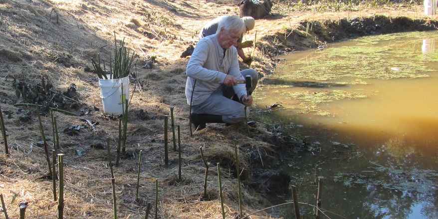
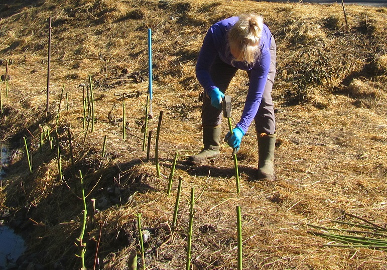
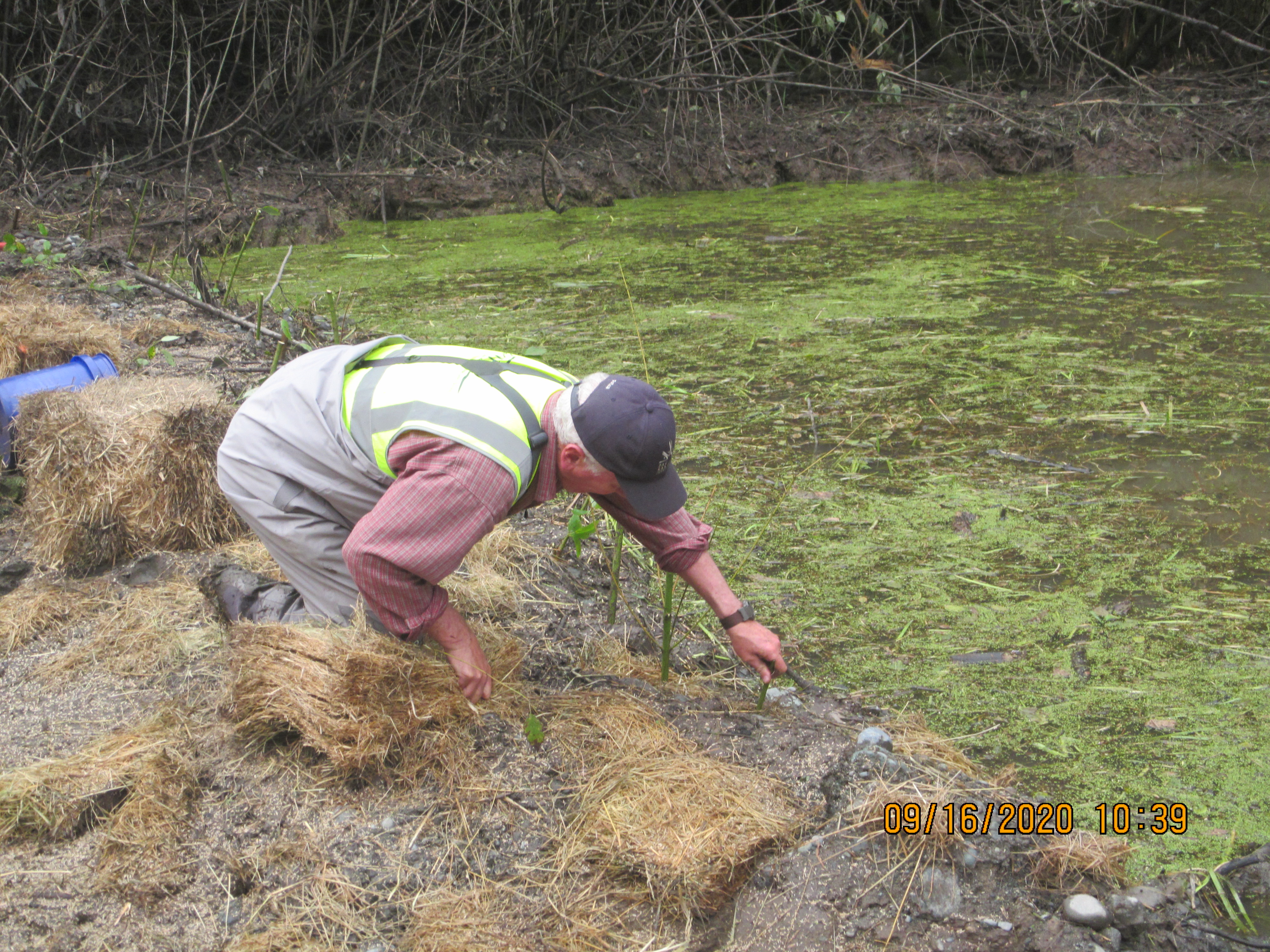
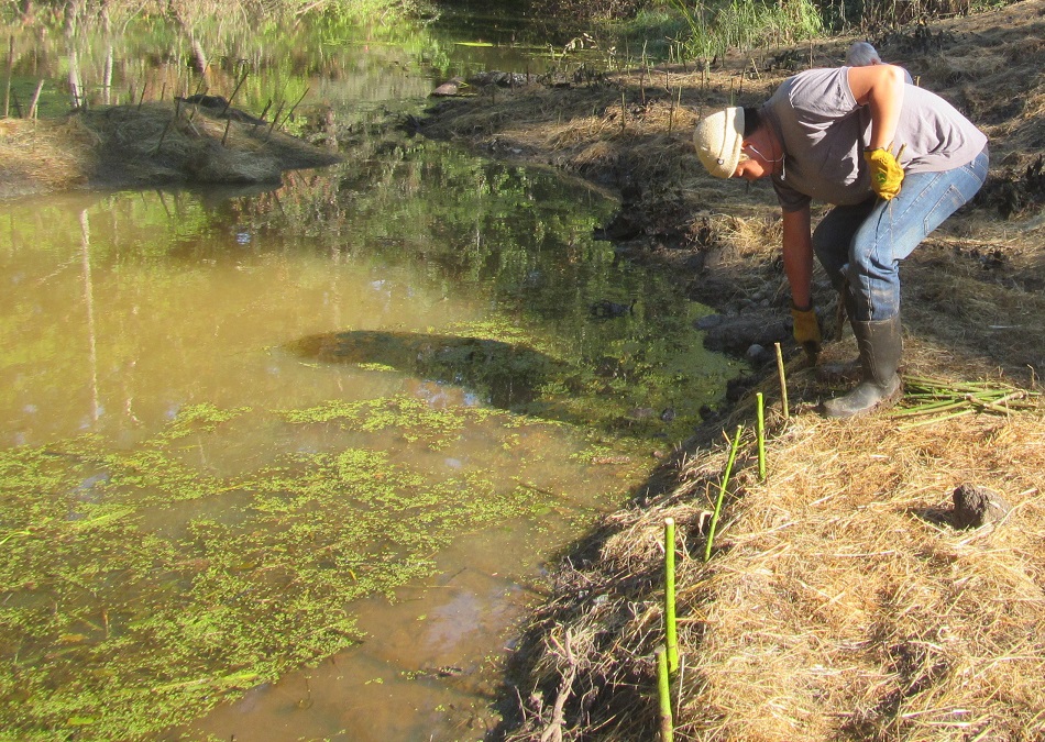
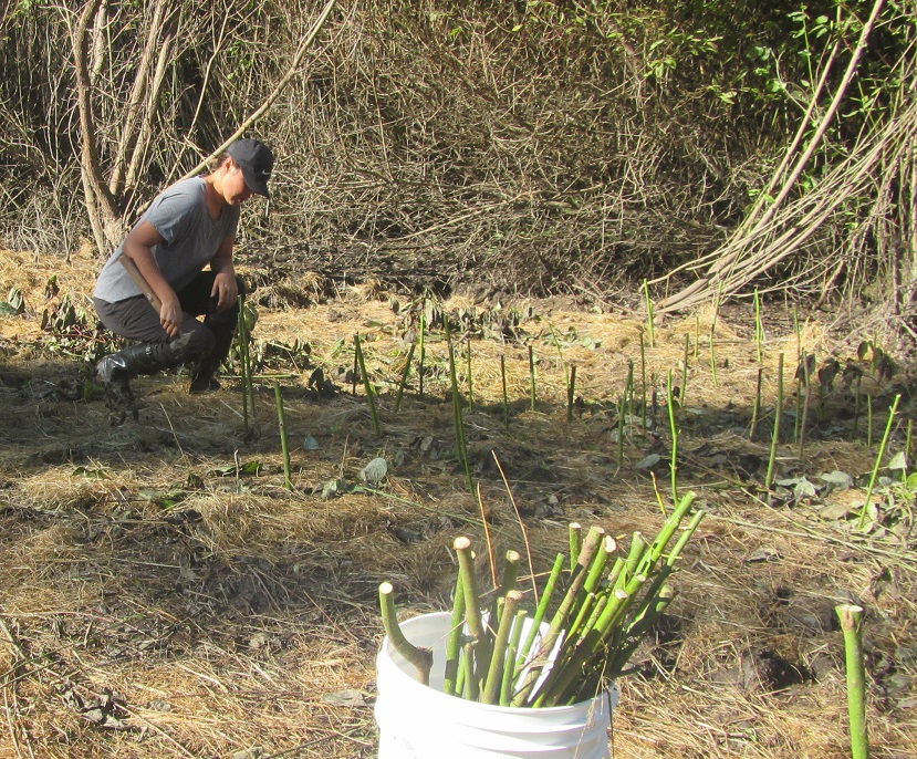
The seed and straw applications were followed by planting red-osier dogwood stakes around the edge of the pond where vegetation was removed. Red-osier dogwood is plentiful at the pond and is a great species for stabilizing the banks of creeks and ponds. Saplings are cut down and then cut into two foot lengths. These are called stakes which are planted about three-quarters of their length into the ground, often using a small sledge hammer. Roots will grow out of the section of stake buried in the ground and soon a new sapling will form. The photos below show some of our stakers. From left to right they are Pat Ashton, Pete Law, John Phillips, and below them, newcomers Quentin Jack-Little and Katrice Baur. Present but not in the photos was Duane Round..
And voila, the finished product. This project was really Carl Rathburn's baby from the start. It's been three years in the making. Carl did all the communicating with land owners, including Shelly Farm, and organizing with Parksville Heavy Equipment and Dave Clough. Carl is in the right hand photo, admiring his new domain.
This project was a huge undertaking and could not have been done without the work by many parties. In addition to Carl Rathburn and the stakers (sounds like a rock 'n roll group), and seeder Shelley Goertzen, mentioned above, MVIHES would like to thank the following people:
Dave Clough (DR Clough Consulting): project design and "Notification for Changes in a Stream"; moved fish from the pond downstream in Shelly Creek; erosion and sediment control; site restoration.
Ryan Christie, John Christie and all the crew at Parksville Heavy Equipment: contractor for pond excavation and site restoration.
Koers Engineering: surveyed and provided engineered drawing of the pond while donating some of their engineering services.
Ken Bergeron et.al., landowners of Martindale Pond: granted permission for work on their property
Murray and Shelly Laplante, landowners of Shelly Farm : granted permission for hauling and spreading sediment on their fields.
Laura Terry, Community Advisor for Department of Fisheries and Oceans: supported project and submitted "Notification for Changes in a Stream".
Dick Dobler, MVIHES volunteer: assisted Dave with fish removal and set up of erosion and sediment control system.
Barb Riordan, MVIHES volunteer and loan shark: completed grant application for $50,000, supplied workers and volunteers with cookies, took some pictures, bossed a few people around.
Our AGM via ZOOM went pretty smoothly for being run by a bunch of tech-challenged Boomers. Included in the AGM was a summary of our activites for the past year (see below). Mike McCulloch, a Fish Biologist with BC Ministry of Forests, Lands, Natural Resource Operations and Rural Development gave a presentation on an exciting study in 2021 on the Englishman River that involves us and a lot of fish. For the video of his presention click here and if you just want to view his power point slide show click here.
Project Report
Past Year in Review:
September 2019 to September 2020
Believe it or not, this past year was one of the most active years in our twenty years as a Society. Even though our volunteer efforts were curtailed by the COVID 19 pandemic, especially our outreach and fundraising activities, we should be proud of the number of projects we completed. Here is a summary of our accomplishments.
Monitoring the Health of Englishman River Watershed
Estuary and Marine Foreshore
Forage Fish – monthly sampling for eggs and embryos continued with positive news of egg presence on the San Pariel beaches, but since MABRRI is supervising this program, their COVID plan has curtailed our involvement since March with MABRRI continuing to survey our sites.
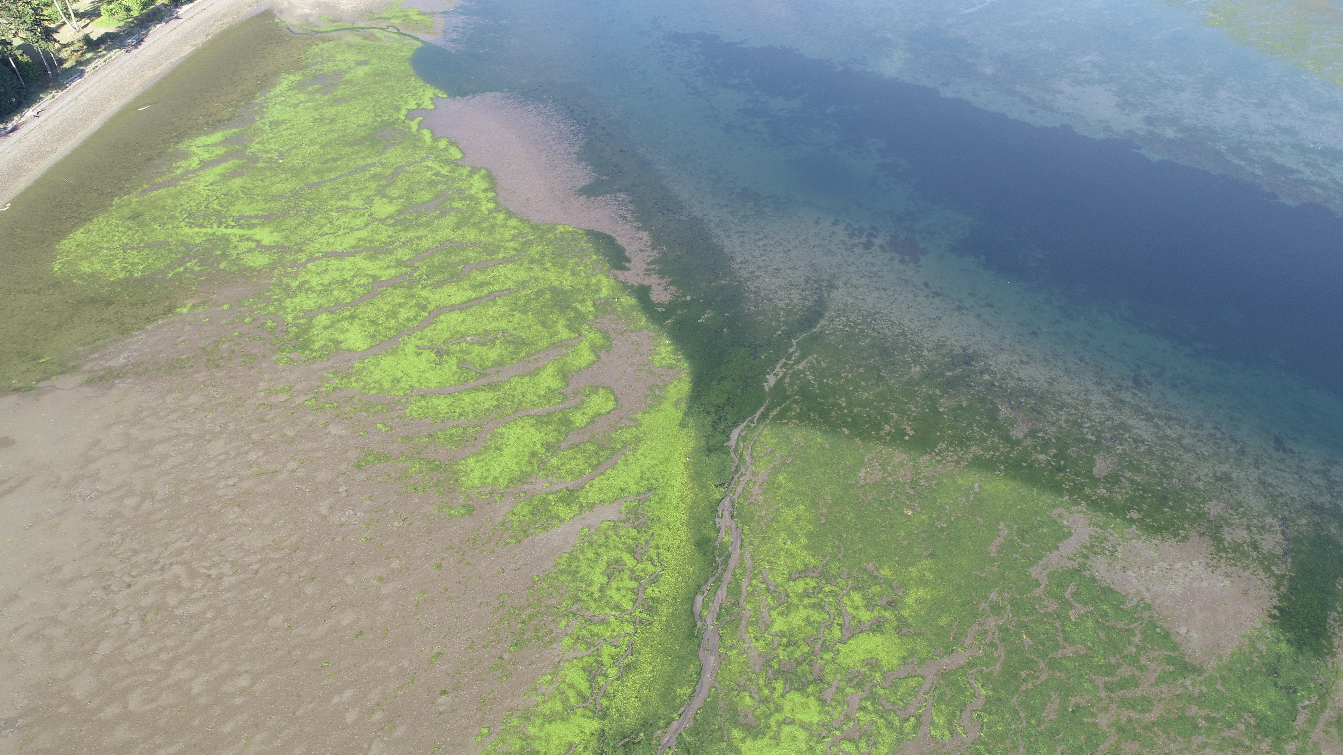
Eel Grass – Drone photo capture of foreshore at low tides in August - from Parksville Bay to Craig Bay in an attempt to establish extent of eel grass beds since the 2008 assessment of eelgrass by MVIHES volunteers.
Estuary Water Quality- Barb led a project to assess water quality in the western portion of the Englishman River estuary. Barb has written the results of the project into a report, and submitted it to all the funders. Highlights of the findings include:
Copper and zinc concentrations exceeded the Water Quality Guidelines for the protection of aquatic life which may have caused negative effects.
Fecal coliform concentrations exceeded Health Canada guidelines for recreational use of water. Caffeine was detected in the water samples indicating some of the coliforms came from human septic. Fecal coliforms do not harm aquatic life, but human septic also contains household detergents, cleaning products and pharmaceuticals that can harm aquatic life.
The source of elevated copper, zinc and most of the fecal coliforms were two Parksville stormwater outfalls that discharge into the estuary.
City of Parksville has developed a water sampling program for all of the Parksville stormwater outfalls.
Low Flow Monitoring in the lower river (July to September 2020)
In an attempt to monitor the impact to flows in the lower river from the movement of the Englishman River Water Services (ERWS) water intake from Turner Rd. to Hwy 19, we had a team of volunteers monitor flows using a FLOWTRACKER . We have used a Drone to capture river habitat conditions at these low flows. Our data will be shared with ERWS and agencies.
Benthic Invertebrate Report completed
In the summer and fall of 2019, we teamed up with Island Waters Flyfishers and Mid Island Castaways, to capture the status of Benthic Invertebrates at 8 sites in the watershed. During the spring months in 2020, while we were locked away due to COVID 19, we were able to generate a report that summarizes the findings. In summary, the species of bugs indicate the water quality in the Englishman River is Good in the upper watershed but decreases to Acceptable below Top Bridge and is only Marginal at the Orange Bridge. The diversity of bugs at each site indicate the habitat, which includes physical features, is Acceptable in the upper watershed and decreases to Marginal below Top Bridge and at the Orange Bridge.
C.W. Young Side Channel Wetland Monitoring
In 2018, two small colonies of yellow iris, an invasive species that fills in wetlands and displaces aquatic habitats, were discovered in the Beaver Pond, a wetland in the side channel. This was a real concern for us because Coho fry inhabit the side channel and their habitat was at risk of filling in with yellow iris, leaving no open water for the fish. Since the side channel is in the Englishman River Regional Park, the RDN contracted the Coastal Invasive Species Committee to remove the yellow iris in summer of 2019. MVIHES was asked to monitor the Beaver Pond for five years, starting in 2019, to document the success of the eradication of the yellow iris and identify other infestations of invasive species. We have monitored the Beaver Pond for two years and have not seen any signs of yellow iris. However, we found an extensive invasion of reed canary grass which fills in wetlands and displaces aquatic habitat, like yellow iris. We will be working with the RDN to find a suitable method for controlling the invasive plant.
Community Watershed Monitoring
We are entering our 10th year of partnering with the RDN on this project. This past year, the RDN’s Drinking Water and Watershed Protection Program had a “strategic plan” report generated (for the next 10 years), and they have identified rainwater management as a key direction they want to act on. Once again COVID protocols have limited the number of volunteers who can participate.
Photopoint Monitoring
We have been conducting photopoint monitoring on the Englishman River since 2015. This involves taking photos along the river in precisely the same locations every few months so that changes in the riverbanks, gravel bars, log jams, etc. can be tracked. This is important for understanding the power of the river and the dynamics of the river channel. We have certainly seen some amazing examples of the power of the river to change its course.
Projects to Monitor the Health of Shelly Creek
Shelly Creek Smolt Fence
Once again, we had a great turnout of volunteers to help us set up the smolt fence this past March. Then the word came down that any field work needed to address COVID issues, so our activities at the trap were very limited, with a team of 2 dedicated volunteers working to produce an accurate count of smolts. This spring (March 15 to early May), we counted 3156 Coho smolts, and 13 trout. A below average year for Shelly Creek, but this represents our 10th year of data collection from this site. This is an impressive dataset – a great example of local citizen science at work.
Shelly Creek Flow Monitoring
We continued our efforts to understand the “water balance” in Shelly Creek. This past year we set up a flow monitoring program with local residents helping us collect the data. Hopefully, this information will lead us to develop projects to sustain flows in summer and moderate high flows in the winter months. We are looking at developing a wetland in the upper watershed.
Ecological Assessment Process of the Shelly Creekshed
The Partnership for Water Sustainability and MVIHES collaborated to produce a report released in April 2020. The review identified the extent to which the community recognizes the Shelly creekshed as a natural commons and evidence that residents, property owners, NGOs, businesses and local governments consider it worth investment of volunteer time, funding and pursuit of a long range strategy for enhancement. As part of this study, we looked at how much money (including volunteer time) has been spent to restore the creek (2010-2020). The rough estimate of expenditures related to maintenance (or remediation) and management (or enhancement) of the Shelly creekshed during the past decade, including work currently in the City of Parksville Parks budget is $300,000.
Restoration Projects Funded/Completed to Support Wild Fish Production in 2020.
Martindale Pond Restoration
This past year saw MVIHES take on one of our biggest fish habitat restoration projects in our 20 year history. The project has been incubating for the past few years with some of our members, and we collected enough data to prove the project’s “time has come”. We asked Dave Clough to review our data on the site, and he concluded that the lower Shelly Creek wetland complex, so important to over-wintering Coho and trout juveniles, was choked with sediments, and needed to be removed. Our team, lead by Carl Rathburn and Barb Riordan, submitted a proposal to the Pacific Salmon Foundation to fund the excavation, and it was approved for full funding. Working with local contractors (Koers Surveying and Parksville Heavy Equipment) who chipped in donated time and equipment, the project was completed over a six day period earlier this month. Over 30 truck loads of sediment were removed and spread into the Shelly Farm fields. Congratulations to Carl, Barb, and our local contractors in getting the job done.
City of Parksville’s Shelly Park Footbridge Installation
The City of Parksville have taken the lead over the past year to recognize the importance of informing and protecting the small population of resident Coastal Cutthroat Trout that reside in Shelly Creek Park. In 2018, as part of the City’s Parks Strategic Plan, MVIHES promoted the idea of a new footbridge in the Park, to help restore a section of important riparian habitat which park users were trampling (unintentionally of course). The City’s Parks Department developed a footbridge project and submitted it to Council earlier this year for funding. Council recognized the importance of the project, and work began in early September to rehabilitate the walkway and bridge crossing adjacent to the creek, to ensure fish and fish habitat were protected from unintentional damage by park users in the future. We congratulate the City for being proactive and getting this project done so the local community can see the wild trout that reside there (year-round) for years to come.
Outreach/Education Projects Funded in 2020
Sensitive Habitat Signs (with the yellow fish) – PSF have funded 4 new signs to be placed at major bridge crossings in the Englishman River and tributaries, including at the Orange Bridge and Highway 19.
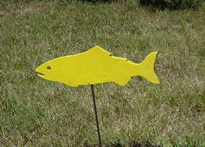
Lawn Fish to Promote Water Conservation – The Pacific Conservation Assistance Fund have awarded funding to MVIHES to spearhead this project which uses “wooden fish” as a symbol of “good water conservation” practices being deployed by residential property owners. We look forward to working with members of QBSS on this project.
What Can we look forward to in 2021?
Hopefully, depending on how our community/country adapts to the pandemic, MVIHES members can look forward to another active year ahead.
For example, this spring (2021) the Pacific Salmon Foundation (PSF) together with the British Columbia Conservation Foundation (BCCF) will implement a tagging study using Passive Integrated Tags (PIT) in a number of Vancouver Island river systems (including the Englishman River) to provide information on survival “bottlenecks” for Coho, Chinook, and Steelhead in both freshwater and early marine environments. This is a three-year project, beginning in 2021. I’m sure MVIHES members will be helping in some field capacity to assist this important salmon and trout habitat study.
 Since 2018, MVIHES has been identifying and sampling forage fish spawning habitat on the beaches from Craig Bay to the Parksville Community Park. Forage fish are small fish that travel in large schools and are a food source or 'forage' for larger fish and marine mammals and birds.They include Pacific Sand Lance (seen in bottom of photo) and Surf Smelt (seen in top of photo) which lay tiny eggs (1mm) on pebble and sand beaches just below the high-tide line - an area called the intertidal zone. It's important to identify and map beaches where forage fish spawn so spawning habitat can be protected from disturbance during the spawning window.
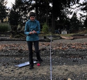
 n early September, we took on one of our biggest fish habitat restoration projects in our 20-year history.
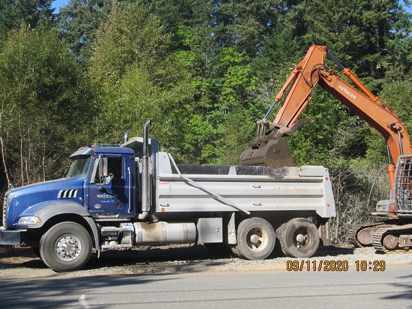
 Biologist Dave Clough (right-hand photo) was on hand throughout the project to make sure erosion control measures were functioning as designed. Following removal of the sediment, the area that had been disturbed by the trucks and heavy equipment was rehabilitated under Dave's supervision using methods that are standard practice for Parksville Heavy Equipment. The area was graded and made smooth so that a fast growing grass seed mix prescribed for erosion control could be spread. Straw was spread over the area for a couple of reasons. The straw will stop the seed from blowing away or washing away in the rain. The straw will also stop the soil from being washed into the pond by the rain.
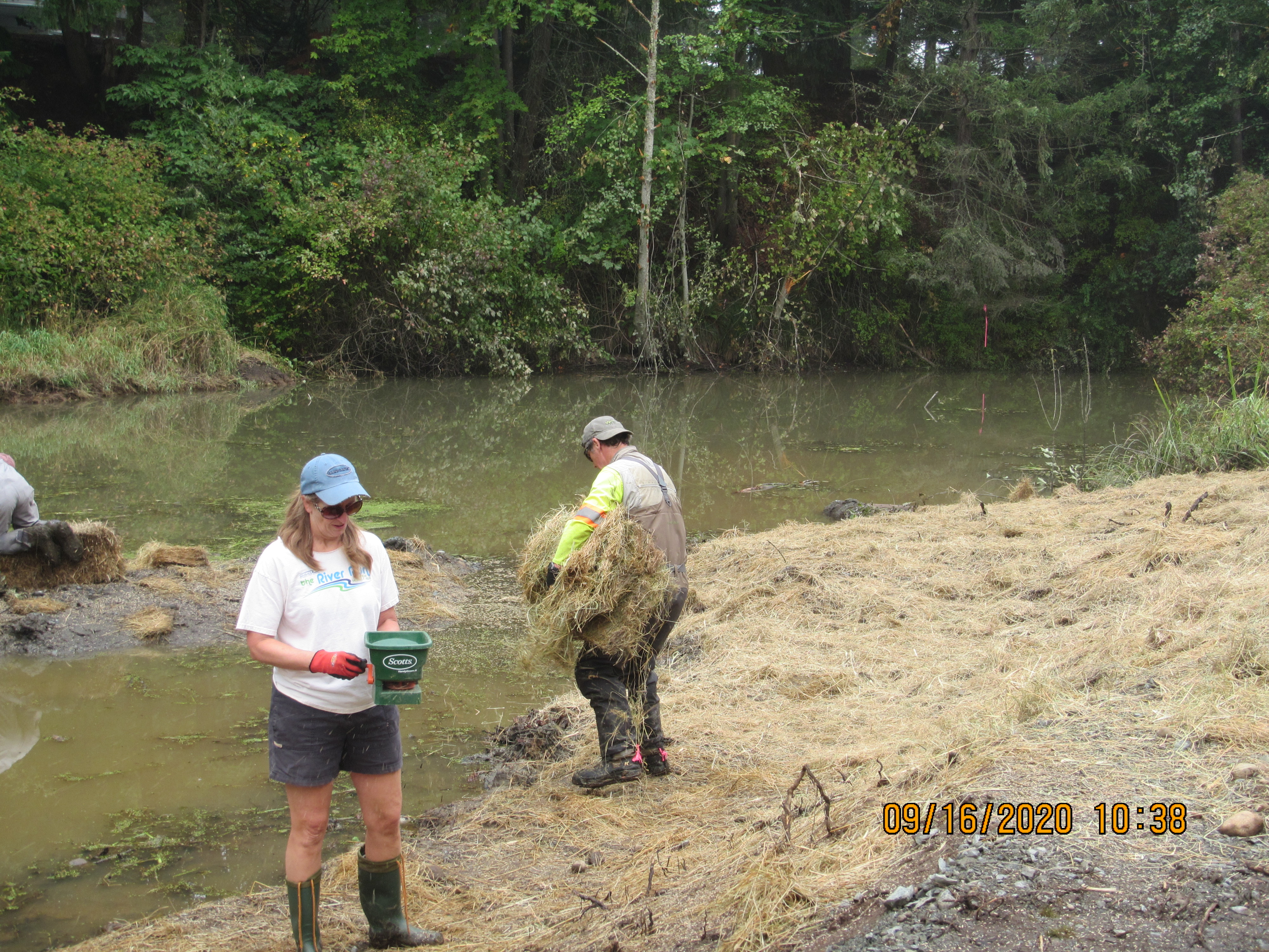

 Copper and zinc concentrations exceeded the Water Quality Guidelines for the protection of aquatic life which may have caused negative effects.
 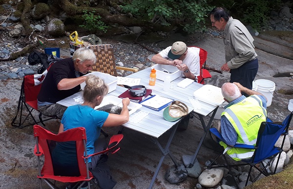 In the summer and fall of 2019, we teamed up with Island Waters Flyfishers and Mid Island Castaways, to capture the status of Benthic Invertebrates at 8 sites in the watershed. During the spring months in 2020, while we were locked away due to COVID 19, we were able to generate a report that summarizes the findings. In summary, the species of bugs indicate the water quality in the Englishman River is Good in the upper watershed but decreases to Acceptable below Top Bridge and is only Marginal at the Orange Bridge. The diversity of bugs at each site indicate the habitat, which includes physical features, is Acceptable in the upper watershed and decreases to Marginal below Top Bridge and at the Orange Bridge.
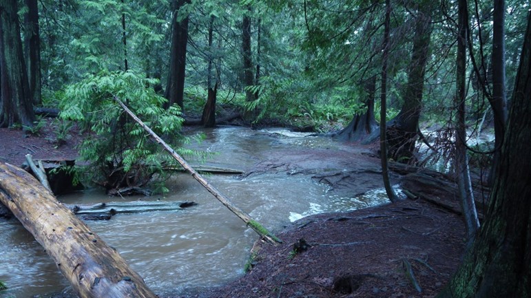 The Partnership for Water Sustainability and MVIHES collaborated to produce a report released in April 2020. The review identified the extent to which the community recognizes the Shelly creekshed as a natural commons and evidence that residents, property owners, NGOs, businesses and local governments consider it worth investment of volunteer time, funding and pursuit of a long range strategy for enhancement. As part of this study, we looked at how much money (including volunteer time) has been spent to restore the creek (2010-2020). The rough estimate of expenditures related to maintenance (or remediation) and management (or enhancement) of the Shelly creekshed during the past decade, including work currently in the City of Parksville Parks budget is $300,000.